Inspections | Survey | Volumetrics | LiDAR | Topographic Surveys
⁉️ Do you have a large site you need data from but struggle to get the data in time?
Difficult to access or unsafe location hampering your survey?
Have you faced delays and budget overruns in construction projects? 🏗️
Need topo data for a large area (50ha to 200ha+)?
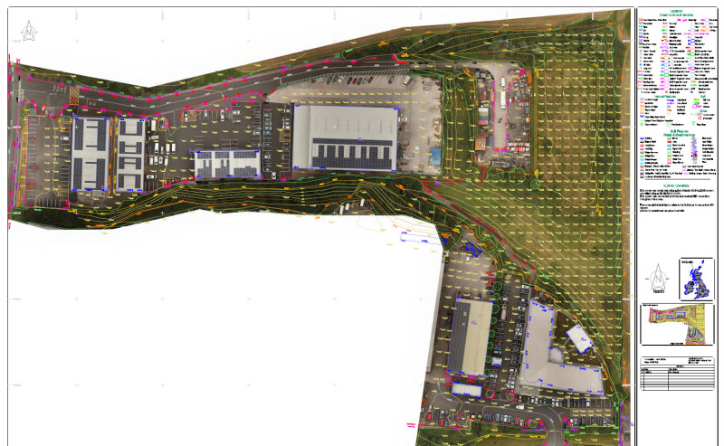
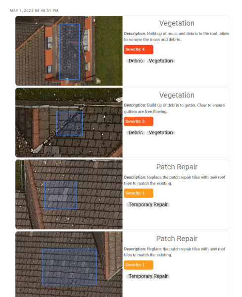
Need CAD roof plans of large commercial buildings?
We're innovating surveys to provide actionable data to keep your project on track.
NOT just pretty pictures.
🛈 We provide timely, accurate site data for land and commecial buildings, to help managers make informed decisions quickly, ensuring your projects stay on track.
100ha / 250 acre in one day!
At DroneWorks, we use advanced drone technology, including LiDAR and laser scanners, to capture, digitize, and deliver site data efficiently, saving you time and money.
👷
Key Benefits:
✔️ Accurate Data: Enables quick, informed decisions, progress tracking, and comprehensive project insights.
✔️ Enhanced Communication: Visualize and report progress with drone images, reducing risks and improving stakeholder communication.
✔️ Increased Efficiency: Safely collect data while reducing on-site risks.
⚠️ Still unsure if you can benefit from drone surveys? DM me, happy to advise 🙌
10% Discount for GB Shared Members
https://www.drone-works.uk/gb-shared
The construction industry is the largest adopter of drone technology at the moment and that is set to continue.
Always use an accredited, insured drone operator:
- CHAS / SafeContractor / Constructionline Accredited
- CAA Approved Drone Operator
- £5m Public Liability
- £1m Professional Indemnity
- Signed the Armed Forces Covenant
- Veteran Owned Business (ex British Army)
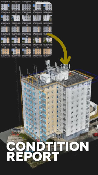
DroneWorks helps with site surveys, earthworks levels and construction progress, using drone technology to collect accurate site data for surveyors, engineers and site managers to get accurate, timely information on site activity, preventing costly re work and ultimately saving you time and money.
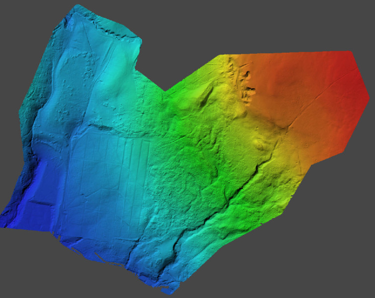
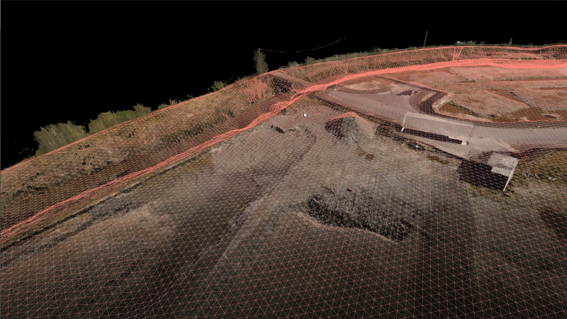
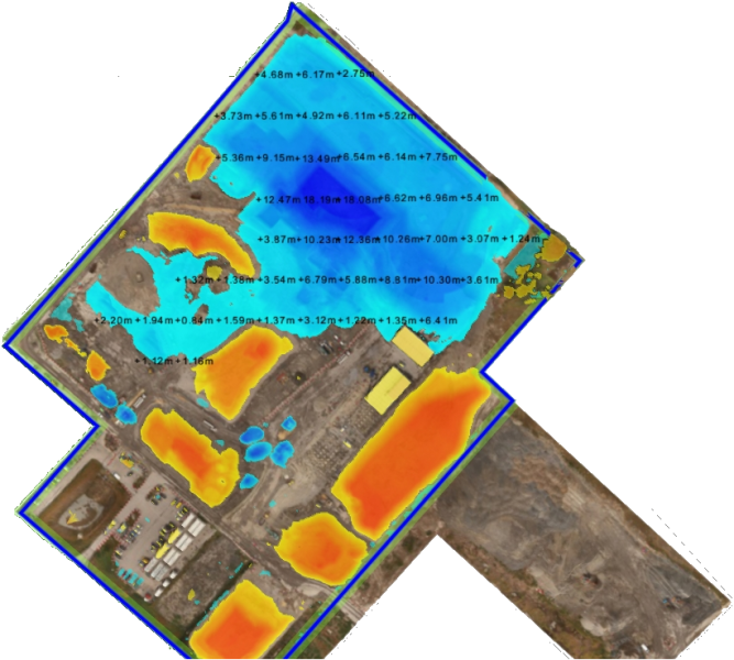
Example, we can survey a 60ha site in a couple of hours, collecting data accurate to RICS surveys standards whilst providing high levels of detail and digitising the site.
The idea being that more regular, accurate data will give you the information you need to make decisions to keep the project on track during ground works & construction phase.
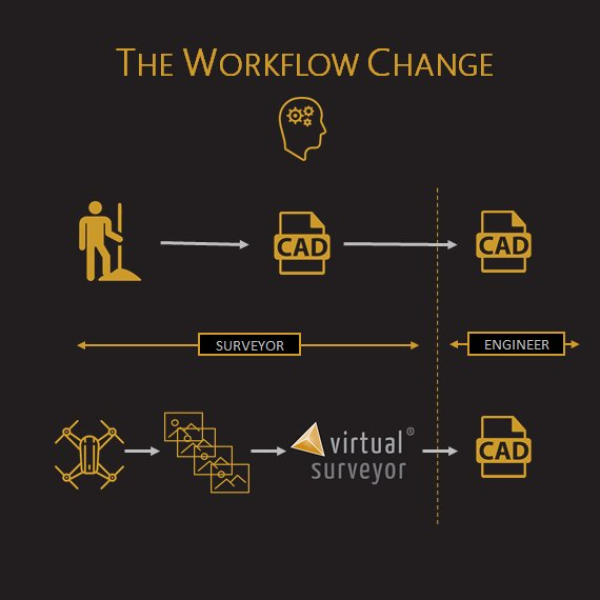
Data collection is 70% quicker than doing it on foot (and safer) yet the result are much more detailed, with the result being a digitised version of the job site. From there you can integrate it with other systems / applications / CAD etc as required.
This is in addition to standard aerial images / video for marketing / promotion.
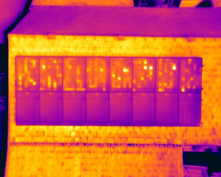
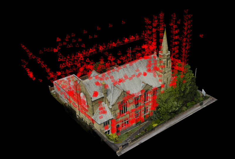
We also have specialist drones and expertise to survey building fabric and insulation and PV panels.
Use cases:
- Site planning
- Earthworks
- Site levels
- As built surveys
- Cut / fill analysis
- Stock pile measurements
- Material Management (MMP)
- Track Site Progress
- Compare As-Designed vs As-Built
- Share with stakeholders
- Site documentation & audit
- Warranty & fulfilment
- Marketing / promotion
 BNI Greater Manchester East & Lancashire