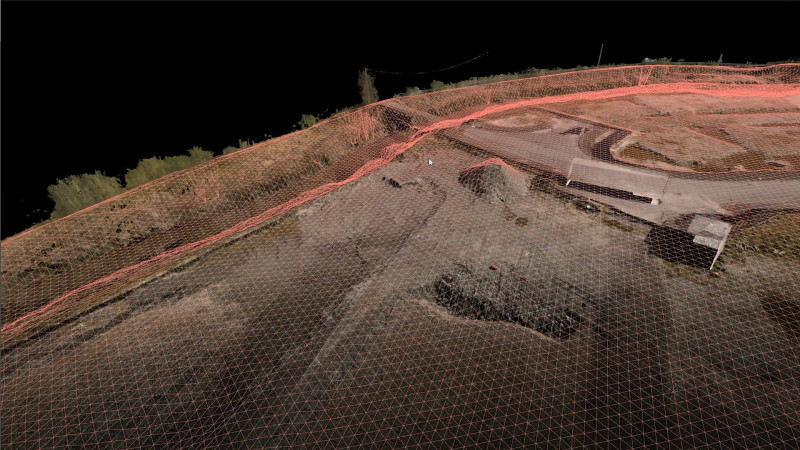
Many UK sites don't give up their ground level easily. Dense vegetation, long linear corridors and hard-to-reach terrain can defeat a camera-only survey before it starts.
Drone LiDAR was built for exactly this problem, and it's becoming a default choice across construction, infrastructure and land projects on vegetated sites.
Whenever ground is hidden by trees, scrub or dense grass, photogrammetry alone struggles to find true ground level - it maps whatever the camera can see, which is often the top of the canopy rather than the earth beneath it.
This is a familiar problem on rail and highway corridors, overgrown brownfield sites and rural land parcels, where a wrong assumption about ground level can throw out earthworks volumes, drainage design or utility clearances before a single spade goes in the ground.
We address this by flying dedicated LiDAR sensors combined with photogrammetry, rather than relying on photogrammetry alone. Laser pulses pass through gaps in the canopy, and enough of them reach bare ground to build an accurate picture of what's underneath, even where vegetation cover is dense.
Flights are tied into survey control using RTK/PPK GNSS positioning, so the resulting point cloud sits on the same coordinate system as any existing site data.
The process typically covers a site in a single visit, with fieldwork measured in hours rather than the days a ground crew would need to walk the same area on foot.
The sectors seeing the biggest gains are the ones with vegetation, distance or awkward access to contend with - rail and highway corridors, utility and energy operators managing vegetation around powerlines, land surveyors and forestry work, and construction sites where a single flight can replace days of ground fieldwork.
It's not the right tool for every job. Photogrammetry is faster and more cost-effective on open, unobstructed ground, usually more accurate too when done properly.
LiDAR earns its higher day rate specifically through its ability to ‘see through’ vegetation.
The question worth asking before commissioning any survey is simple: how much of this site is genuinely hidden from a camera, and can the provider show their ground control and expected accuracy rather than just quoting a headline figure?
We've written up the full picture, including what a LiDAR survey actually delivers and the accuracy standards it needs to meet on UK projects.
Read the full article 👉
https://blog.drone-works.uk/post/drone-lidar-surveys-accurate-ground-data-where-cameras-can-t-see-20260803
 DroneWorks